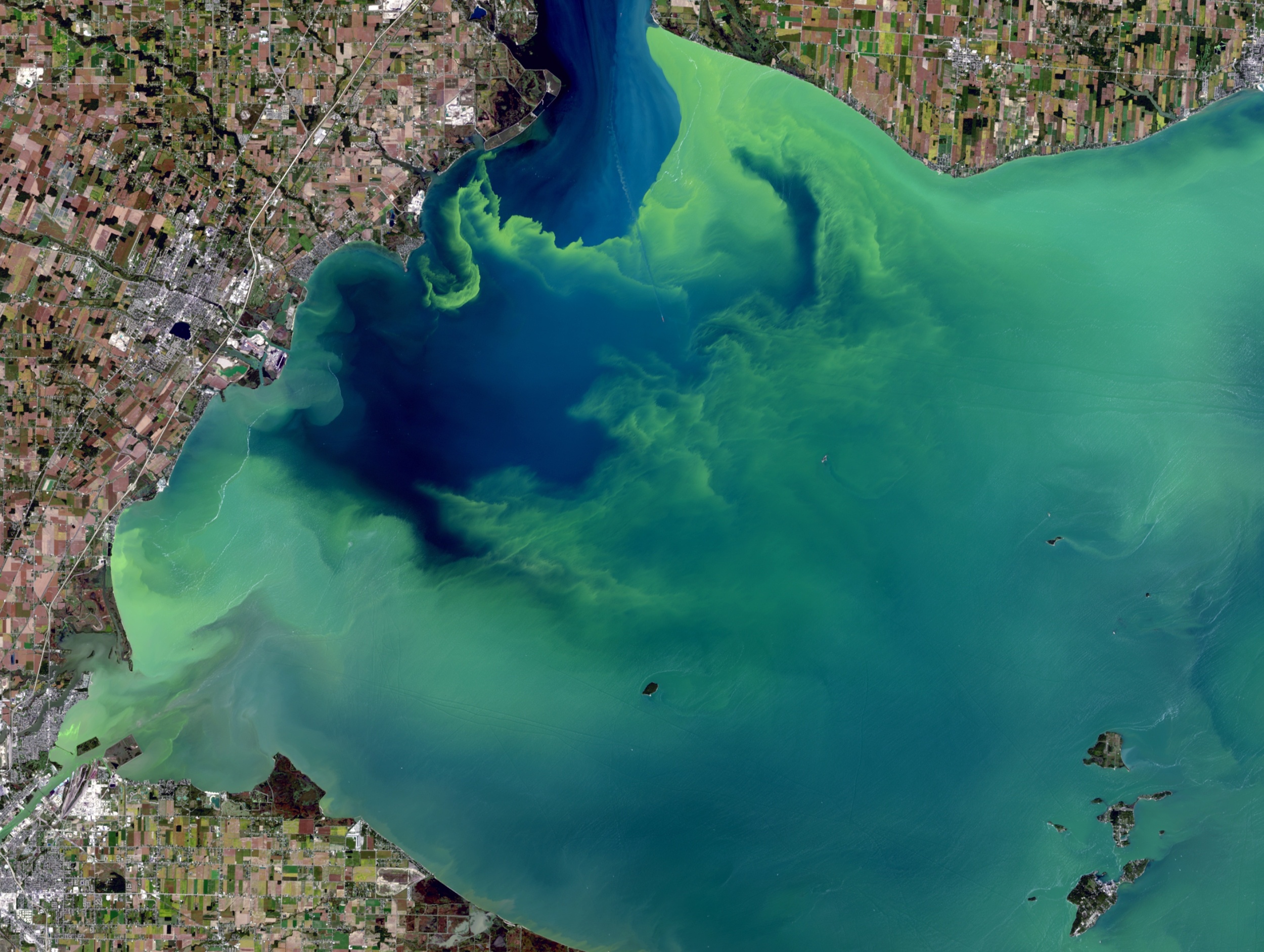
Harmful algae blooms can quickly turn a normal beach day into a public health concern.
The tool combined data from several satellites and detected harmful algal blooms in western Florida and Southern California.
Florida communities such as Tampa Bay and Sarasota have struggled with harmful algal blooms for decades.
That means the AI learned patterns from large streams of satellite data without needing humans to label every example first.
NOAA also works with states and local partners to produce harmful algal bloom forecasts during bloom seasons.
Harmful algae blooms can quickly turn a normal beach day into a public health concern. Some blooms kill fish and marine mammals, while others make the air difficult to breathe.
Severe outbreaks can also shut down shellfish harvesting, tourism, and other coastal businesses that rely on clean water.
The hard part is timing. By the time people see discolored water or dead fish, the bloom may already be spreading.
Testing water still requires boats, sample collection, lab work, and often a day or more of waiting.
That leaves coastal communities asking a tough question. Where should they look first?
A need for earlier detection
NASA scientists have built an artificial intelligence tool that may help answer that question.
The tool combined data from several satellites and detected harmful algal blooms in western Florida and Southern California.
Severe blooms can pose health risks and cost coastal economies in the United States tens of millions of dollars every year.
Florida communities such as Tampa Bay and Sarasota have struggled with harmful algal blooms for decades.
In the Gulf of Mexico, the algae species Karenia brevis can trigger red tide outbreaks that kill wildlife, foul beaches, and cause respiratory problems in swimmers and beachgoers.
On the West Coast, Pseudo-nitzschia blooms have poisoned hundreds of dolphins, California sea lions, and other marine animals in recent years.
Some algae toxins can even drift into the air and cause respiratory illness in people.
Satellites already help track blooms from orbit, but coastal water is messy. Sediment, runoff, plants, shallow bottoms, and changing light can confuse the view.
One satellite may catch one clue. Another may catch a different one. The trick is pulling those clues together.
The research team included Michelle Gierach of NASA’s Jet Propulsion Laboratory in Southern California, Kelly Luis of NASA JPL, and Nick LaHaye of Spatial Informatics Group.
They brought together findings from five space missions or instruments, including NASA’s PACE satellite and TROPOMI.
PACE can identify algal communities by traits such as size, shape, and pigment. TROPOMI can pick up the faint red glow that some algae give off during photosynthesis.
Together, these tools can help show not just that something is in the water, but what kind of bloom may be forming.
Training the AI system
The team used a self-supervised machine learning system. That means the AI learned patterns from large streams of satellite data without needing humans to label every example first.
Field and lab measurements then helped connect those patterns to real-world conditions.
The system trained on satellite data from 2018 and 2019. Scientists tested it on later periods in the same regions.
Early results showed that the tool could correctly identify and map harmful blooms, including specific species such as K. brevis, even in complicated coastal waters.
“At the very least, a tool like this can help us know where and when to collect water samples as an algal bloom is starting,” said Gierach.
“It can also drive collaboration between specialists, fostering new ways to conduct the science and deliver decision-support products.”
Better warnings, fewer blind spots
Health agencies already test waters and issue warnings or beach closures when needed. NOAA also works with states and local partners to produce harmful algal bloom forecasts during bloom seasons.
AI would not replace those efforts. It could help point them in the right direction sooner.
“Applying self-supervised AI to massive streams of satellite data is rapidly becoming a powerful tool for generating actionable ocean intelligence,” said Nadya Vinogradova Shiffer, lead program scientist at NASA Headquarters in Washington.
The goal is to create “maps without gaps.” No single satellite can capture everything, and no boat crew can test every stretch of coastline.
But combining space-based observations with water sampling could give officials a much clearer picture before a harmful bloom turns into a larger crisis.
Broader implications of the research
The team is improving the tool with more data from more coastlines. They also plan to test it in other water bodies, including lakes.
The research has implications for drinking water, fisheries, aquaculture, and local economies far beyond ocean beaches.
“The aim of this work is to start to bridge technologies to better serve end users and their needs, from aquaculture to tourism,” Luis said.
“To do that, we’re going to bring all our NASA assets to the table.”
For coastal communities, the goal is simple: know sooner, respond faster, and waste less time guessing where trouble is starting.
The full study was published in the journal AGU Earth and Space Science.
Image Credit: NASA/USGS
—–
Like what you read? Subscribe to our newsletter for engaging articles, exclusive content, and the latest updates.
Check us out on EarthSnap, a free app brought to you by Eric Ralls and Earth.com.
—–