Following an invisible underground routeWhat the dye revealedMalad Gorge State Park.
Mapping the Aquifer's Hidden ConnectionsIn 2010, scientists poured fluorescent green dye into a domestic well in southern Idaho and tracked its underground movement.
The study examined Idaho’s managed aquifer recharge programme, which was developed to help replenish the aquifer by adding water to the groundwater system.
It provided physical evidence that locations which appear separate at the surface can be connected through underground flow pathways.
Malad Gorge lies in a region where groundwater emerges through numerous springs along the Snake River.
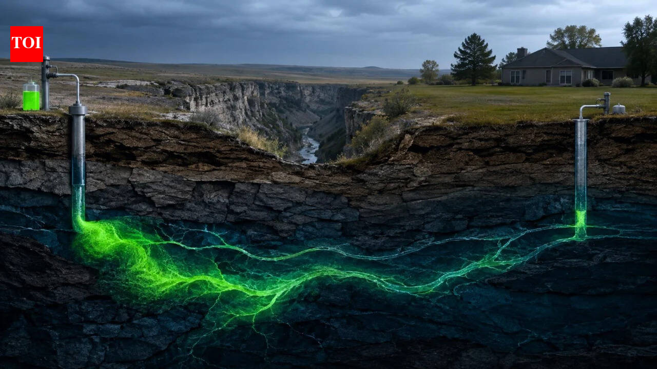
Representation of fluorescent dye released into a well. Image Credits: ChatGPT.
Following an invisible underground route
What the dye revealed
Malad Gorge State Park. The gorge is located along the Snake River in southern Idaho. Image Credits: Wikimedia Commons.
Mapping the Aquifer's Hidden Connections
In 2010, scientists poured fluorescent green dye into a domestic well in southern Idaho and tracked its underground movement. The experiment near Malad Gorge State Park showed that groundwater could move through the fractured volcanic rock of the Eastern Snake Plain Aquifer at speeds approaching 2,000 feet a day, giving researchers a rare glimpse into pathways that normally remain hidden beneath the surface.According to a report by the Idaho Department of Water Resources , the 2010 tracer test was carried out in cooperation with Idaho Power to investigate groundwater movement near Malad Gorge State Park. Researchers released fluorescein dye into the Hopper domestic well, located about 5,490 feet southeast of the gorge, and monitored springs along the river edge and selected domestic wells for traces of the dye. The experiment used a two-phase approach, first identifying the direction and distribution of groundwater movement and then measuring travel time. The Hopper well was not pumped during the test, allowing the dye to move under natural groundwater conditions. Researchers recorded the dye moving toward the gorge at an average linear velocity of 664 feet per day, with a maximum measured velocity of 1,996 feet per day.The experiment was particularly useful because of the aquifer’s unusual geology. Much of the Eastern Snake Plain Aquifer consists of successive basalt lava flows formed by ancient volcanic activity.Fractures, rubble zones and other highly permeable features between and within these flows can create pathways for groundwater. This complex structure means water does not necessarily move slowly or uniformly through the subsurface. Instead, it can travel through interconnected fractures and permeable zones, making groundwater movement difficult to predict from surface conditions alone.According to research published in Groundwater , the Eastern Snake Plain Aquifer is Idaho’s largest and most productive aquifer. It has experienced substantial decline since the early 1950s, linked to changing climate conditions, increased water demand and evolving irrigation practices. The study examined Idaho’s managed aquifer recharge programme, which was developed to help replenish the aquifer by adding water to the groundwater system. The programme aims to support the long-term sustainable management of the aquifer by capturing available water and recharging it into the system.For scientists, the experiment mattered for more than showing that groundwater could move rapidly underground. It provided physical evidence that locations which appear separate at the surface can be connected through underground flow pathways. Malad Gorge lies in a region where groundwater emerges through numerous springs along the Snake River. Understanding these connections is important because the Eastern Snake Plain Aquifer supports irrigation, communities, and other water uses across southern Idaho.The Idaho Department of Water Resources records the tracer work as part of a series of groundwater investigations in the area. Earlier tests were conducted closer to the gorge, while later experiments involved wells progressively farther away. A test using the Meyer well, about 2.25 miles southeast of the gorge, recorded a maximum groundwater velocity of about 1,100 feet per day. Further tests using the Victor well, about 3.1 miles southeast of Malad Gorge, were conducted in 2012 and 2013, with tracer detections reported at domestic wells and springs along the groundwater-flow path.The Malad Gorge tracer experiments showed why understanding groundwater pathways can be as important as knowing where water is stored. By making an otherwise invisible flow path measurable, the fluorescein tests provided evidence of how groundwater moves through the fractured basalt beneath southern Idaho. This information is particularly relevant as Idaho uses managed aquifer recharge to replenish the Eastern Snake Plain Aquifer.The dye tests did not produce a complete map of the underground system, but they revealed connections that might otherwise have remained difficult to detect. For an aquifer that supports agriculture, communities and connected river systems, identifying these pathways can help scientists and water managers better understand how groundwater moves through the subsurface and how the aquifer responds when water is added to the system.