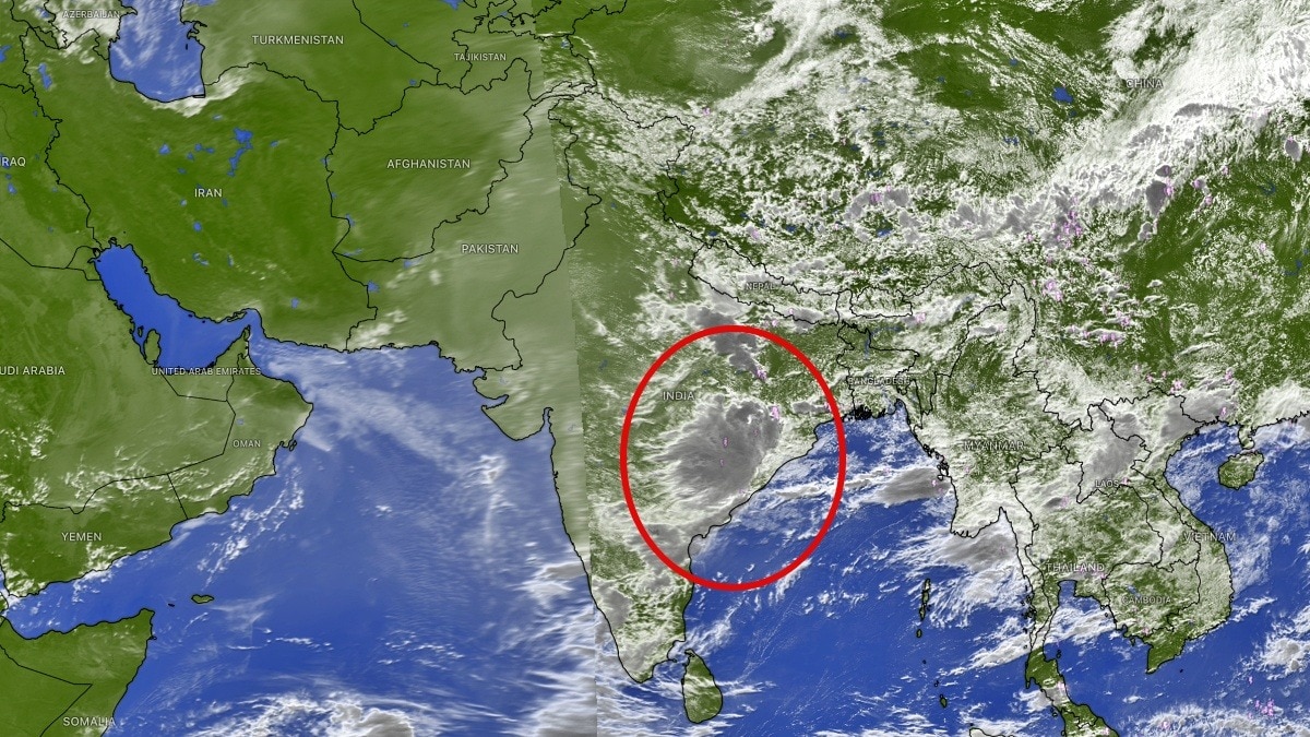
After nearly a week of subdued monsoon activity, satellite imagery is signalling that the southwest monsoon is preparing for a dramatic comeback.
Uttarakhand could receive 300-500 mm of rain during the week, while Uttar Pradesh may record 200-350 mm.
Rainfall over Haryana and the Delhi-NCR region could range between 100 and 150 mm, while eastern Rajasthan may receive 75-200 mm.
Even parts of western Rajasthan, which have remained relatively dry, are expected to receive 25-75 mm of rainfall.
The expected revival is welcome news for agriculture, as recent monsoon weakness had slowed kharif sowing and widened rainfall deficits across several states.
After nearly a week of subdued monsoon activity, satellite imagery is signalling that the southwest monsoon is preparing for a dramatic comeback.
Fresh images from INSAT-3DR and international weather satellites show a powerful low-pressure area over the northwest Bay of Bengal, with dense convective cloud bands spreading across Odisha, West Bengal and adjoining eastern India.
Meteorologists say the weather system, coupled with the monsoon trough shifting south from the Himalayan foothills towards its normal position, will trigger a widespread revival of rainfall across northern India beginning this weekend.
Read Full Story
The satellite images reveal towering thunderstorm clouds wrapping around the low-pressure area as it moves inland from the Bay of Bengal. The system is expected to travel northwestwards, drawing enormous amounts of moisture into the Indo-Gangetic plains and central India.
The first phase of the revival will bring heavy rainfall to Odisha, Gangetic West Bengal, Jharkhand and eastern Uttar Pradesh before expanding further north and west.
According to current weather projections, Uttar Pradesh and Uttarakhand are likely to witness widespread heavy rainfall from Saturday, with the wet spell extending into Punjab, Chandigarh, Delhi, Haryana and eastern Rajasthan from Sunday into Monday.
Forecast models indicate that the period between July 19 and July 25 could become one of the most active monsoon spells of the season for northern India.
Rainfall accumulation is expected to be significant across several states. Uttarakhand could receive 300-500 mm of rain during the week, while Uttar Pradesh may record 200-350 mm. Himachal Pradesh and Jammu are forecast to receive 150-300 mm, with Punjab and Chandigarh likely to see 100-200 mm.
Rainfall over Haryana and the Delhi-NCR region could range between 100 and 150 mm, while eastern Rajasthan may receive 75-200 mm. Even parts of western Rajasthan, which have remained relatively dry, are expected to receive 25-75 mm of rainfall.
The expected revival is welcome news for agriculture, as recent monsoon weakness had slowed kharif sowing and widened rainfall deficits across several states.
A sustained wet spell could replenish soil moisture, improve reservoir inflows and help narrow seasonal rainfall deficits over north and central India.
However, the strong revival also brings the risk of hazardous weather in the Himalayan region.
Meteorologists caution that the combination of intense rainfall and saturated mountain slopes could increase the likelihood of landslides, flash floods and isolated cloudburst events, particularly across Uttarakhand and Himachal Pradesh.
Travellers heading to the hill states over the weekend and early next week have been advised to monitor weather updates and exercise caution.
If the forecast holds, the coming week could mark the most significant monsoon turnaround of the season, ending the recent dry spell and restoring widespread rainfall across large parts of northern India.
- Ends