Click for next articleThis composite image uses NISAR data to show vegetation in the area around South Africa.
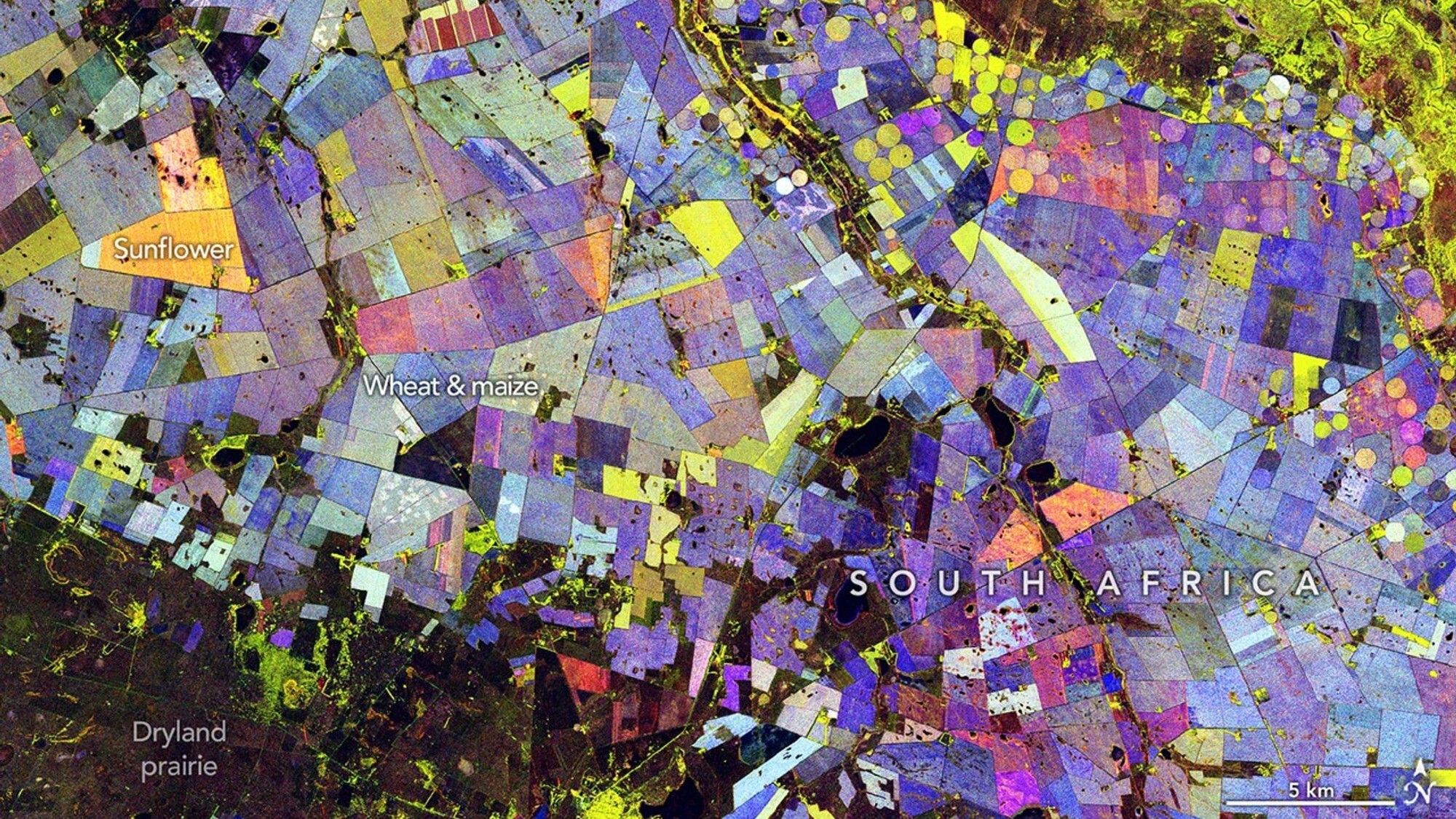
A rainbow blanket of patchwork colors sprawls across South Africa in this new composite image created using data from NASA's latest Earth-observing mission.
In this image, you can see the region along the Vetrivier (Vet River, or "fat river") in South Africa.
The data captured by NISAR in this image was used to create color-coded blocks that point to details like crop type.
This river feeds local agriculture, supporting crops across the wider Maize Triangle region, a major agricultural area in the country.
Click for next article
This composite image uses NISAR data to show vegetation in the area around South Africa. (Image credit: Image by Paul Siqueira (UMass Amherst) of the NISAR science team using data from the NISAR GCOV product , and prepared for NASA Earth Observatory by Michala Garrison.)
A rainbow blanket of patchwork colors sprawls across South Africa in this new composite image created using data from NASA's latest Earth-observing mission.
This image incorporates information from NISAR (NASA-ISRO Synthetic Aperture Radar), a satellite developed jointly by NASA and ISRO (the Indian Space Research Organisation), to show details of land use down here on Earth.
What is it?
NISAR launched on July 28, 2025 on an Earth-observing mission. It tracks natural disasters and studies ecosystems, agriculture, glaciers and other facets of our planet's surface.
In this image, you can see the region along the Vetrivier (Vet River, or "fat river") in South Africa. This area includes a wide-reaching agricultural region north of Bloemfontein. The data captured by NISAR in this image was used to create color-coded blocks that point to details like crop type.
The Vetrivier flows through the Free State and North West provinces. This river feeds local agriculture, supporting crops across the wider Maize Triangle region, a major agricultural area in the country.
Why is it incredible?
This image is equal parts beauty and science. NISAR and other Earth-studying satellites are key players in our constantly evolving understanding of our planet.
In the pretty abstract color blocks overlaid on this image, green points to an area with vegetation, red means an unvegetated area, and shades of blue depict how quickly a vegetated area changed within the recent season.
Signup to our newsletter Follow us on Google