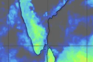
The weather department has forecasted widespread heavy rainfall across the state over the next 24 hours.
AdvertismentAccording to the alert, several places are likely to receive heavy to very heavy rainfall, while isolated locations may experience extremely heavy rainfall.
This will result in heavy to very heavy rainfall as there is a possibility of this moving towards interior areas.
Some regions will experience extremely heavy rainfall.
The regions which were breathing a sense of relief after the floods cleared recently, Odisha will likely experience similar situation again."
India Meteorological Department (IMD) has issued a red warning for Odisha. The weather department has forecasted widespread heavy rainfall across the state over the next 24 hours.
Advertisment
According to the alert, several places are likely to receive heavy to very heavy rainfall, while isolated locations may experience extremely heavy rainfall.
An upper air cyclonic circulation is currently centred over south Gangetic West Bengal and adjoining Bangladesh. Under its influence, a low-pressure area is likely to form over the coastal areas of Gangetic West Bengal and the adjoining north-west Bay of Bengal within the next 24 hours. This development is most likely to trigger intense downpours across the region.
Advertisment
Rainfall Figures Recorded Across Districts
Heavy downpours were registered in several parts of Odisha over the last 24 hours. Narla in Kalahandi district recorded the highest rainfall in Odisha at 131 mm.
Other key rainfall figures recorded during the same period include:
Madanpur Rampur (Kalahandi): 117 mm
Belgaon (Bolangir): 115 mm
Athagarh (Cuttack): 112 mm
Mahanga (Cuttack): 104 mm
Salebhata (Bolangir): 103.4 mm
Meteorological Expert Comments On Flood Risks
Weather experts noted that the active weather system will move inland, prolonging the wet spell across interior districts.
Also Read: Cyclonic circulation to trigger rainfall for 5 days in Odisha; IMD issues orange alert
Assessing the weather pattern, meteorology expert Debasish Jena said, "An upper air cyclonic circulation is already active near Odisha over Bay of Bengal. This will result in heavy to very heavy rainfall as there is a possibility of this moving towards interior areas. Some regions will experience extremely heavy rainfall. Its effect will remain intact for another 24-48 hours. The regions which were breathing a sense of relief after the floods cleared recently, Odisha will likely experience similar situation again."