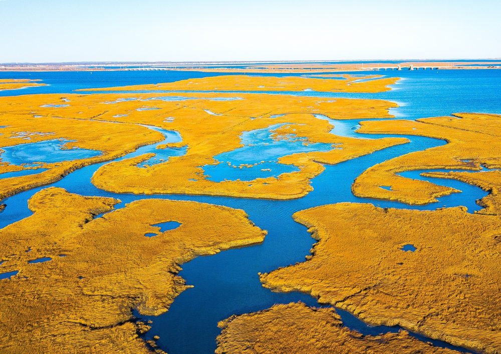
They are losing a slow race: sea levels are climbing, and coastal wetlands are drowning under the tide.
Tides deliver sediment, plants add root material, and the marsh surface builds upward year after year.
The new study finds that 89 percent of American coastal wetlands are still gaining elevation that way.
Those coastal wetlands sit lower against the tide each year as sea level climbs, which is what researchers call submergence.
That tolerance runs out, noted Glenn Guntenspergen, a coastal wetland ecologist with the U.S. Geological Survey (USGS) and senior author of the study.
Salt marshes and mangroves rim the three coasts of the contiguous United States. They are losing a slow race: sea levels are climbing, and coastal wetlands are drowning under the tide.
That race reaches well beyond the marsh. Wetlands blunt storm surge, shield roads and buildings, and shelter migratory birds and endangered species.
The first national assessment has now measured how that race is going. Across the contiguous coasts, 84 percent of wetlands are inundating, and many are headed toward open water.
Sea level rise is drowning wetlands
Wetlands survive rising seas by rising with them. Tides deliver sediment, plants add root material, and the marsh surface builds upward year after year.
The new study finds that 89 percent of American coastal wetlands are still gaining elevation that way. However, only 16 percent are gaining it fast enough to outpace the water.
The rest are falling behind. Those coastal wetlands sit lower against the tide each year as sea level climbs, which is what researchers call submergence.
Submergence does not look dramatic from shore. It shows up as longer flooding, thinning vegetation, and eventually bare mud and open water.
Plants have their limits
Higher water is not automatically bad for a marsh. Up to a point, extra flooding stimulates wetland plants and helps them build soil, which is why many marshes have persisted this long.
That tolerance runs out, noted Glenn Guntenspergen, a coastal wetland ecologist with the U.S. Geological Survey (USGS) and senior author of the study.
“All coastal plants have optimum ranges,” he said. “But if they get flooded too much, then the system shuts down. The plants decrease production and eventually die.”
The water is also arriving faster. Global sea level rose about 0.07 inches (1.7 millimeters) a year through the 20th century, and 0.15 inches (3.8 millimeters) a year from 2006 to 2018.
Data from 450 stations
Earlier work on wetland elevation mostly covered a handful of sites at a time, because the fieldwork is slow and physically punishing.
Reading the analog instruments that track sediment buildup and land subsidence takes hours. Researchers haul heavy gear across soft, wet ground to reach them.
Some sites can only be entered by boat, and Guntenspergen recalls one so remote it required a helicopter. “The logistics are quite daunting,” he said.
The team instead pulled together records from nearly 450 monitoring stations spread along the contiguous coasts, some of them that have been running as long as 20 years.
Comparing those elevation records with tide gauge data showed which marshes were keeping pace with the water and which were quietly falling behind.
Gulf Coast fares the worst
Justine Neville is a wetland ecologist at Duke University (Duke) and lead author of the study. The national result did not shock her.
“I was not very surprised, to be honest,” she said. “A lot of the literature that we’ve read from all the different regions is showing similar results.”
The regional split did stand out. Submergence is slow enough at about 75 percent of Atlantic monitoring stations to rule out any critical threat. This is also helped by sediment that ocean waves push ashore.
The Gulf Coast is the opposite case. Wetlands from Texas to Louisiana are drowning under a stack of human pressures that are layered on top of sea level rise.
Shipping canals have reworked the region’s waterways and cut the river sediment that once fed the marshes.
Oil and gas extraction has lowered underground pressure enough that the land above subsides.
Room to move inland
The more useful finding, in Neville’s view, is not how many wetlands are drowning. It is how many still have somewhere to go.
“What is really important about what we found, though, is how many of these wetlands have the opportunity to migrate,” she said.
Seventy-three percent of the wetlands in the study still have room to expand inland rather than drowning in place, provided the slope is gentle and no buildings or roads block the path.
That space is not shared evenly. Gulf wetlands may have the most room to retreat, while hills and cliffs hem in their Pacific counterparts.
Where the path is open, managers have levers: removing dikes, adding sediment to starved marshes, and protecting the inland ground that a wetland would need to move into.
What the map is for
None of this makes the losses reversible everywhere. The work is observational, built from stations that already existed, and it covers the contiguous coasts, not Alaska or Hawaii.
It also describes how wetlands have responded to the sea level rise already recorded. It does not predict the year any single marsh will disappear.
“Our study provides wetland managers with new information to help them make better-informed decisions and identify meaningful solutions to issues they may be encountering, including to facilitate wetland migration upslope,” explained Guntenspergen.
The map, in other words, is a triage tool. It marks the places where sediment, space, or a removed dike would buy the most marsh.
“It’s not all doom and gloom,” said Neville. “Yes, there is an urgency to understand what’s happening with our wetlands, but one thing this paper can demonstrate is where we might want to focus our [conservation] efforts.”
The study is published in the journal Earth’s Future, an open-access title from the American Geophysical Union.
—–
Like what you read? Subscribe to our newsletter for engaging articles, exclusive content, and the latest updates.
Check us out on EarthSnap, a free app brought to you by Eric Ralls and Earth.com.
—–